Quick editorial note: So, I’m so sorry. I made a mistake. On my posts for days 2 and 3, I had referred to the Flatirons as if they were this sprawling range of foothills. After more research, I discovered that the name only refers to the five large sandstone formations that dominate the foothills on the west side of Boulder. So when we thought we were exploring the Flatirons, we actually were exploring the Front Range, the range of mountains in the Rockies that runs from Casper, Wyoming to Pueblo, Colorado. You’ll notice those corrections as you read on.
Waking up on my first morning in Boulder, I discovered that I clearly had a sleep deficit of about 10 hours. So, accounting for that and for the time I needed for my mandatory three morning teas and for my usual checkin with my favorite political blog (don’t vote for Trump, whatever you do, or I shall be very angry and shall never forgive you), I don’t think I actually was out the door until 11:00. But slow, slow mornings are (sometimes) just the right thing when on holiday.
It was on this first morning in Boulder that I finally got to meet up with my friends Amy and Aaron who also traveled here by car (but not before experiencing a life-or-death moment with a blown out tire on their rental car in the middle of Nebraska which delayed them two hours). Meeting up with friends was the other restriction beyond no flying and no high densities of people that we carefully followed while traveling: that is, keep separate households separate (so, don’t drive in the same car and don’t stay in the same Air BnB). I do hope you follow these suggestions as well, or I shall be very angry with you and shall never forgive you.
My Air BnB was on the south side of Boulder in the very residential and somewhat characterless Martin Acres neighborhood (apparently named after the Martin Farm, an apple farm that used to be on the land, but which started to get replaced in the 1950s by a housing development for World War II vets), and Amy and Aaron’s Air BnB was to the northwest of me in a neighborhood that Google maps seems to label Lower Arapahoe (as far as I can tell, so named due to its placement mostly south of Arapahoe Avenue, an avenue that takes traffic west and east across Boulder’s belt line, an avenue which itself is named after the Native American people who used to live in the area), but this neighborhood didn’t seem to have much of a web presence, so my guess on the reason for its name is just that.

Regardless, while the Lower Arapahoe neighborhood lacks a web presence, it makes up for itself in character. Indeed, in some ways, a lack of web presence suits this neighborhood quite well, and I wouldn’t be surprised if its residents also think the same, as it’s a very Boulder, Colorado neighborhood: a hippy artist commune, if you will. But before you chastise my choice of words, I can’t speak for the residents to confirm that there actually are any hippies or artists or communists living in this neighborhood, nor do I mean to suggest that all inhabitants in Boulder are hippies or artists or communists, but I do mean to use those three words as an endearingly lovely and desirable description of a charmingly delightful and welcoming people.
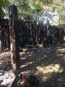
As I walked up to Amy and Aaron’s Air BnB, I was pleasantly surprised to see that they were staying in a small two story house situated right next to the enchanting Marine Street Sculpture Gardens by artist Kevan Krasnoff, who immediately confirmed that at least one artist lives in a neighborhood that I thought might’ve housed hippies, artists, and communists, and who also was Amy and Aaron’s gracious host who gave us many lovely tips regarding where to drive to scope out the mountain landscape and autumn colors. But, before we took heed his suggestions and headed out by car, we wanted to check out on foot one of Boulder’s more famous streets, Pearl Street (but not before briefly admiring the Hannah Barker House, which we happened upon by accident, which is a house that in the late 1800s belonged to a woman of the same name who the History Colorado Center describes as a businesswoman, teacher, civic leader, and philanthropist).

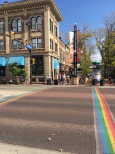
Arriving on Pearl Street (partly a pedestrian mall, partly open to traffic, but mostly an eclectic street populated with restaurants, coffee and tea houses, and various other shops), we made our way east, passing through intersections where pedestrian crosswalks were painted in the pride rainbow colors. The street was bustling with pedestrians and bikers, and everyone (as far as I could tell) was wearing a mask. There also was an anti-male circumcision demonstration happening right outside the Boulder County Commissioners building, men and women holding signs proclaiming, “STOP THE CRUELTY!” and “STOP CUTTING BABY PENIS!” (I did find myself remarking sarcastically, “Does anyone in Boulder actually disagree with these demonstrators? Certainly I don’t.”) After acknowledging the demonstrations, we continued carrying on to our final destination on Pearl Street…
…but before I write any further, I do find myself now in a curious position, as Colorado (along with 10 other states) rather exists in a weird legal grey area regarding a specific, ahem, plant where the state government says one thing but the federal government says another. I will tread carefully and simply say that I went into one of those shops, and I’ll leave you to your imagination what I did inside. I will reveal, however, that the staff I spoke to inside were so, so friendly and knowledgeable, answering all our questions so informatively, even a question I asked that cracked me up, which was, “Which one is good for laughing?”
Following our excursion on Pearl Street, we headed back to Amy and Aaron’s Air BnB, hopped in their rental van (we felt that if I sat in the way, way back and they in the way, way front and we had our windows open, masks on, and kept the drive to under a few hours, that our risk of exposure would be quite low), and made our way north to Left Hand Canyon Drive, a scenic drive that takes visitors through the Flatirons Front Range, the rocky formations that make up the foothills on Boulder’s west side of town. We actually didn’t really know what we were doing on this drive, as we joined Left Hand Canyon Drive partway in via Lee Hill Drive. We would later learn a better route that I will tell you more about for my next post.

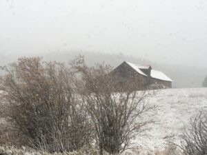
The drive we did end up enjoying, however, was still quite lovely all the same. As I had mentioned in my previous post, it had been a long, long time since I had been in the mountains. And while the Flatirons Front Range are technically foothills and not mountains, they are still alluringly majestic and breathtakingly gorgeous. We had planned this drive to hopefully view the blazing autumn colors that Kevan had promised us, but instead found ourselves navigating the Left Hand Canyon Drive on a blusteringly cold day with sharp, ice-like rain that slowly gave way to a sudden snowfall that just managed the slightest coating of light, fluffy powder over every tree branch and every roof.
As I indicated earlier, we didn’t know it at the time, but we actually got slightly mixed up on the map (the mistake was basically my fault), and later on we would discover that we actually mostly drove on James Canyon Drive through a quirky town called Jamestown. It was still a lovely drive despite the error, even if we couldn’t see the Flatirons Front Range very well on account of the snowfall, but if you have time, I’d still recommend a drive on James Canyon Drive in addition to the full length of Left Hand Canyon Drive. Regardless of whether you’re heading west on either of those drives, however, you will still eventually find yourself on Peak to Peak Highway. We elected to take Peak to Peak north all the way to South Saint Vrain Drive, which took us east all the way to a small town called Lyons. By this point, we were very much out of the foothills and were navigating instead the flatter and slightly more arid ranch lands that didn’t have a single sign of any snowfall, a totally different climate compared what we had just experienced in the foothills.
From Lyons, we went slightly out of they way on our way back to town to visit Avery Brewing Company, a brewhouse on the way north end of Boulder: one of those brewhouses that makes good beer (its apricot sour provides a mouth puckering exclamation of zesty citruses), but one of those brewhouses where the building itself provides little atmosphere due to its unimaginative cement floors and predictable long wooden tables with high top seats. Since outdoor seating was out of the question due to a heavy wind, we opted to buy a healthy selection of sour ales and other beers. I can’t say I’d recommend a trip out of the way to visit Avery, but I certainly would recommend a trip out of the way to a liquor store to buy their beer.
Since the weather had turned quite windy, we knew that dining outdoors for dinner wouldn’t be possible. So, we decided to make a dinner at Amy and Aaron’s Air BnB. Indeed, it was a birthday dinner for Amy! We enjoyed steaks broiled in the oven, cheesy scalloped potatoes (we jokingly called the potatoes Irish lasagna on account of the layers of potatoes, cheese, sauce, and chives), and grilled asparagus. It was–very much so–a happy, happy birthday to a very best friend!
Stray Observations:
- Left Hand Canyon is named after Chief Left Hand of the Arapahoe tribe. The canyon itself also traces the ice cold and quite lively Left Hand Creek.
- James Canyon (along with Jamestown, James Creek, and Little James Creek), was named after James Smith the gold discoverer.
- South Saint Vrain Drive (like Left Hand Canyon Drive and James Canyon Drive) also has a creek with the same namesake: South Saint Vrain Creek. We stopped for a moment on our drive to Lyons to admire its rushing rapids and clear water.
- It was lovely to see a ballot box outside Avery Brewing Company. If you haven’t already, make sure you get out and vote. Either vote now or vote on election day. And whatever you do and in the name of peace and sanity, do not vote for Trump.
For my next post, I’ll catch you up on our hike up Viewpoint Trail, another visit to Pearl Street, and a more thorough drive through Left Hand Canyon.
